• support@srp.aero

SRP Aero is an Official Agisoft Metashape Reseller

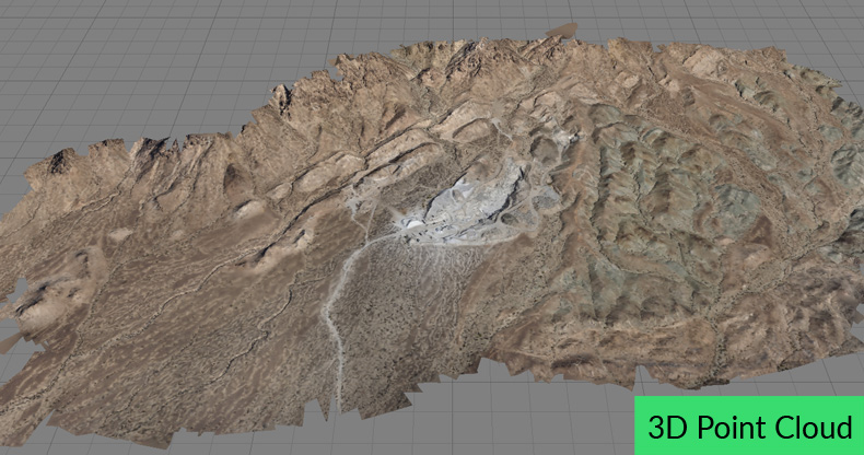
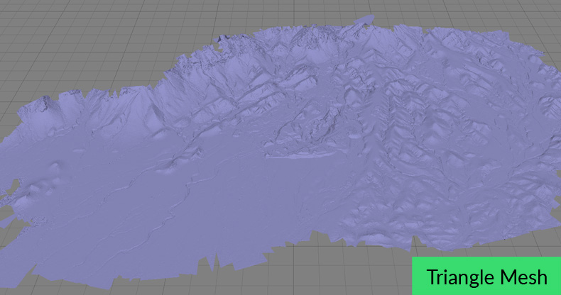
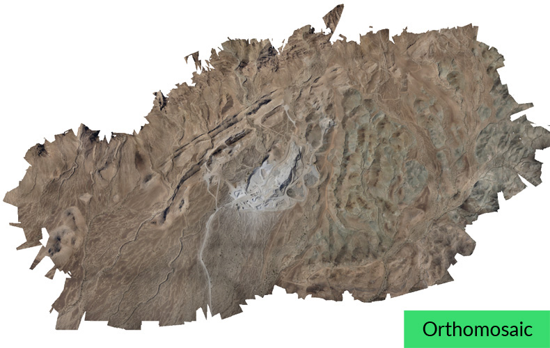
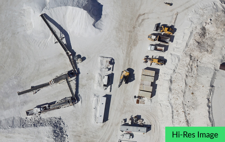
SRP Aero is an Agisoft Metashape reseller. Metashape is professional photogrammetry software designed for creating GIS content. Aerial images captured by Lynx VTOL and other drones are processed and geo-referenced into a single data set. From this single data set, you export digital surface models (DSM), orthomosaics, 3D models, point clouds and more. Final applications include volumetrics, contour maps, and planimetrics.

SRP Aero has used Agisoft’s photogrammetry software since 2013 for aerial mapping and is proud to be an official reseller for Metashape.

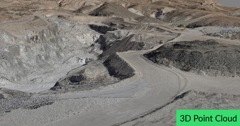
Geo-referenced imagery processed by Metashape creates point clouds, orthomosaics, and 3D reconstruction. Applications include elevation maps, isolines, planimetrics, water flow analysis, simulations, augmented reality, and crops health monitoring.

Contact support@srp.aero for order inquiries.

3D point cloud of a quarry in Agisoft Metashape

3D point cloud of a quarry mapped by Lynx VTOL.
triangulated mesh a quarry in Agisoft Metashape

Triangulated mesh of the same quarry.
orthomosaic of a quarry in Agisoft Metashape

Zoomed-out and uncropped orthomosaic photo. Over 5,000 images contributed to create this 5 sq km orthomosaic photo.

Overlapping aerial images, captured by Lynx VTOL, are processed by Metashape to produce 3D models via stereophotogrammetry.

Zoomed-out aerial photo of quarry machinery. Thousands of high-res images like this are used to produce accurate orthomosaics and 3D models.

3D dense point cloud of a quarry road viewed in Metashape.

Contact support@srp.aero for order inquiries.

Metashape Brochure
Metashape Brochure